Technology
From camera to zone observation, on site.
ParkSense analyzes camera video of your outdoor lot on hardware at the property. Each zone becomes a record with an occupied count and the time it was observed, and the review queue turns the readings that need judgment into a clear next step for staff.
Below: the pipeline, what happens when a view goes stale, the site questions that shape a deployment, and how data is handled.
-
01
Camera coverage
Fixed cameras cover the zones in the site plan: storefront rows, main lot, entrances, pickup and overflow.
Video · on site
-
02
On-site processing
Hardware at the property analyzes the video and maps what each camera sees onto named zones and spaces.
Mapped views
-
03
Zone observation
Each zone is written as a structured record: occupied count, capacity and the time it was observed.
Count + observed time
-
04
Review queue
Readings that need judgment open a review item: a zone close to full, a blocked view, an after-hours vehicle.
Item with an owner
-
05
Staff action
A person sends an attendant, opens overflow or changes signs. Payment and permit systems stay the record.
Decision by a person
Freshness
What happens when a camera view is stale or blocked?
A zone without a fresh observation stays unknown. The view keeps the last observation time visible and identifies the gap for review. In the sample parking view, the site total remains unavailable until every scoped zone is current, so an old count or an unseen area never becomes a current zero.
A parked truck, a dirty lens, glare or a network drop can all interrupt a view. The review queue names the zone and the time it was last seen, so a person can check it.
| Zone | Occupied | Observed |
|---|---|---|
| Storefront rows | 63 / 66 | 17:42 · current |
| Main lot | 88 / 140 | 17:41 · current |
| Pickup & loading | 5 / 8 | 17:42 · current |
| Overflow | Unknown | Last seen 16:58 · needs a check |
| Site total | Unavailable until every scoped zone is current | |
Why process at the edge
Do the heavy work where the video is.
Analysis happens on site, next to the cameras. That keeps the demanding part of the work local, reduces reliance on streaming continuous video somewhere else, and reduces each site's dependence on its uplink.
Streaming continuous video off site
ParkSense · analysis on site
-
01
Close to the cameras
Video is analyzed where it is captured, on hardware at the facility. The site’s map of zones, rows and spaces lives alongside the analysis that uses it.
-
02
Less video in transit
Sites rely less on streaming continuous video off site. What normally travels is structured events; anything beyond that is agreed with each customer.
-
03
Plan for interruptions
Define on-site storage, backup power and event delivery during site setup, then test recovery before launch. Delivered events carry identifiers, so a repeated delivery is recognised rather than double counted.
What the edge produces
Structured events, not hours of footage.
The edge turns video into records with a type, a place and a time. That changes how quickly a team gets an answer, and what else the information can be used for.
| Question | Continuous footage | Structured events |
|---|---|---|
| Knowing how full a zone is | Someone counts on screen, or walks the rows. | Occupancy by zone with its observed time; a stale reading shows as unknown. |
| Deciding where staff go next | Based on radio calls and the last walk-around. | A review item names the zone, the reading behind it and the person who owns the check. |
| Finding a specific dealership vehicle | Someone scrubs through recordings from several cameras. | A search returns the last observed zone, row and space, with the time it was seen. |
| Starting a review | Begins with a time window and a hunch. | Begins with a specific event, its place and its history. |
| Feeding reports and other systems | Needs manual work before it can be reused. | Consistent records with documented types that other systems can read. |
Where visual context helps a review, what is kept, for how long and who can see it is defined with each site.
See the anatomy of an event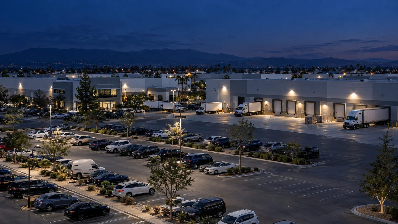
Illustrative scene
Site and deployment
Every site is planned, not assumed.
For an open paid lot or strip mall, coverage follows storefront rows, entrances, loading areas and overflow, including glare, tall vehicles and the hours you operate. Camera positions, lighting, mounting, power and network are planned with your team before deployment. The guides below help you prepare.
- Coverage
Every space you need to understand must be visible: sightlines, overlap between cameras, and occlusion from tall vehicles, trailers and landscaping.
Planning camera coverage- Lighting
A lot changes between midday glare, dusk and night. Coverage is planned for the hours that matter to the site, including after-hours review.
- Mounting
Height, angle and stability decide what a camera can see. Existing poles and building faces are assessed before anything new is installed.
- Power
Edge hardware needs dependable power in a protected, accessible location, planned with your facilities team.
Edge site readiness- Network
A segmented connection between cameras and the edge, and a defined path for events to reach the people and systems that use them.
Edge site readiness- Mapping
Zones, rows and spaces are named the way your team already talks about the lot, so search results and events read naturally.
Mapping a vehicle lot
Integration boundaries
Clear lines between the product and your site.
ParkSense provides a defined set of capabilities. How they connect to your cameras, people and systems is scoped together, site by site.
ParkSense provides
- On-site edge processing, and the lot map of zones, rows and spaces
- The operator experience: zone occupancy, lot map, history and review queue, plus vehicle search for dealerships
- Structured events with documented types and stable identifiers
- Event access for systems your organization authorizes
Defined with each site
- Which cameras, areas and spaces are covered
- Which systems receive events, and how they connect
- Who has access, and to which views
- How long data is kept, and what, if anything, leaves the site
- How exceptions route into your existing processes
Stays in your current platforms
- Payments
- Permits
- Ticketing
- Enforcement
Payment and permit systems stay the record of purchased sessions and parking entitlement. ParkSense adds zone occupancy, observation times and review records alongside them, connected through a plan agreed for each site.
Data handling principles
Decided with you, site by site.
How data is handled is part of scoping each site, not an afterthought. These principles shape that conversation.
-
01
Defined per site
Retention, access and what leaves the site are agreed with each customer as part of scoping a deployment. No single default is assumed for every lot.
-
02
Role-based access
Access follows roles as a design principle. A porter’s search, a manager’s map and a security reviewer’s queue each show what that role needs.
-
03
Narrow by design
Events describe vehicles, spaces and times. The schema is kept deliberately small, and new fields are added on purpose rather than by default.
-
04
Unknown stays unknown
Missing or stale observations are labeled as such. Gaps are not filled with old data or guesses.
-
05
Synthetic data in public demos
The product tour on this website runs entirely in your browser on generated sample data. It shows no customer data and no camera feeds.
Responsible use
Designed around vehicles, decided by people.
-
01
Vehicles and spaces are the subject.
ParkSense is designed around vehicles, spaces and time: where a vehicle is, how a space is used and when something changes. Each deployment is scoped to that purpose.
-
02
People make the decisions.
ParkSense flags what needs attention and routes it to the right role. A person reviews it, decides what it means and records the outcome.
-
03
Built for your existing workflows.
Structured events and review outcomes feed the parking, security and operations processes your team already runs.
Plan a site
Talk through your lot with our team.
Share the layout, the cameras you have or plan, and the questions you need answered. We will work through coverage, edge placement and how events would reach the people and systems that use them.